- This topic has 9 voices and 18 replies.
-
AuthorPosts
-
March 4, 2007 at 4:10 am #2844
A friend of mine sent me this questions from a friend of hers. It’s very interesting. I’ve heard before claims that there were Saponi in the vicinity of Goldsboro, NC, but this is the first time I’m seeing some original source on it.
I want to know where the Saponi camps would have been in about 1749. I know they were on the south side of the Neuse River, but I’m trying to pinpoint how far up the Neuse they were. I’m asking because one of my white ancestors (he was not Indian at all, to the best of my knowledge) was granted land near there. I’m trying to figure out what community that may be today…
“WILLIAM MACKINTOSH 13 October 1749 200 acres in Johnston County on the S. side of the Neuse River on a place called Powells run near Sapony Camps, joining near the sd. run.”[/indent]
If you know anybody who knows anything about Saponi history, would you mind passing this question on. Again, this is NOT about me having a Saponi ancestor, because I’m quite certain I don’t. This is only a geographical question.
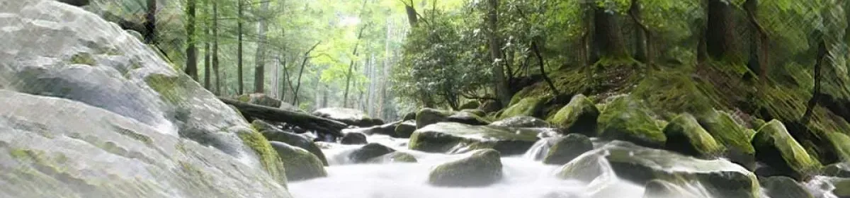
I think a detailed map of Johnston County would probably still show a Powell’s run. Those place names seem to endure. I know when I lived in Greene county, Fort Run was still named for Fort Neoheroka. I’ve seen references to the Saponi having lived in caves at the Cliffs of the Neuse. I’ve never found out what the original source for that is, either.
I think it was 1752 that the Tutelo were adopted by the Cayuga in Canada. The adoption occured some time after they moved up there. This document placing Saponi in Johnston County, NC in 1749 is interesting, since it would imply that there were still Saponi left in the South after many had gone north. Of course, it could be that the reference was to some old Saponi camps no longer inhabited in 1749, but the wording does seem to imply they were there at that time. I wish I’d known all this when I was still living there.
March 4, 2007 at 4:10 am #25176I rely on “The North Carolina Gazeteer: A Dictionary of Tar Heel Places” by William S. Powell (who ought to be good on Powell’s Creek?), UNC Press, Chapel Hill, 1968. No Powell’s Run listed, and nothing in Johnston County. He lists:
Powell Creek in Buncombe County (obviously too far west); Powell Creek that rises in Virginia, flows into Northampton County NC, into Meherrin River; Powell Creek in eastern Wake County flows into Hodges Mill Creek; Powells Creek rises in Halifax County and flows into Little Fishing Creek; former Powells Creek now known as Whitaker Creek that rises in Pamlico County and flows southeast into the Neuse (!); and Powells Pocosin in NW Bertie County.(A Pocosin is a tidal swamp.)
None of these seem to be in Johnston County and none, if I read it right, on the south Bank of the Neuse, since the one in Pamlico flows southeast into the Neuse. But the one in Wake County That flows into Hodges Mill Creek is interesting since Hodges Mill creek flows into the Neuse according to the Gazeteer, it would seem to be the only one on the south bank of the Neuse. If it’s indeed in Johnston County I think I’d look upriver from Goldsboro, closer to Wake County and Raleigh. A quick(too quick) look at the DeLorme North Carolina atlas didn’t immediately find either creek, but I think upriver is the best bet.
I can’t help but note that this area is actually not that far,as the crow flies, from areas Franklin, Warren, and Halifax Counties associated with the Haliwa-Saponi and other groups. It’s all pretty close together, at least in the automobile age.
Let me know if you locate the site more precisely. I have roots around there.
Michael Dunn
March 4, 2007 at 4:10 am #25178Also: It’s late and I’m lazy about googling but does anyone know off the top of their head where the Tuscarora Path crossed the Neuse? That might have something to do with this.
Michael Dunn
March 4, 2007 at 4:10 am #25184Looks to me as if the main crossing — probably depending on when you mean — was at present Smithfield NC. There was another one much farther upstream, where I guess it’s called the Eno River; also that’s not in Johnston Co., and the local village was Shakori/Eno. But by 1749 the few survivors of that tribe were mostly considered Sapony (or Catawba). Anybody settled as far east as Goldsboro would, I believe, have been Tuscarora.
You might try this link, and look at their modern poster, as well as several historical maps you can open. I like the 1733 one. Didn’t find Powell’s Creek, though.
http://www.tradingpath.org/index.php?option=com_weblinks&catid=27&Itemid=44
March 4, 2007 at 4:10 am #25191PappyDick,
I met with members of The Trading Path Assn at Mt Tirzah on the Flat River today for a hike of part of the trading path between South and North forks of the Flat River as designated on Moseley’s 1733 map. Portions of the wagon road and mule path as well as the river ford are still quite obvious. This is woodland that has been undisturbed for 300 years (except for some “hand” logging at places… no heavy equipment used so the footprint of the land hasn’t been changed by this 50 to 100 year old logging)
March 4, 2007 at 4:10 am #25193Good Morning…..my name is Dianne.
(I too have the family oral history of Blackfoot/Cherokee from Pennsyvania-Virginia-Ohio-Illinois to Newton County Indiana.) This is my first post although I joined last August and visit multiple times a day.
I just found a fun site regarding the Neuse River Basin with maps.
http://www.epa.gov/nerlesd1/land-sci/lcb/nrb/VFRDB/
If you click the “Neuse River Basin Vegetation” link at the left of the page you come to a database of the trees with multiple pictures of each species. I’d most like to be walking through the forest; but this site makes wonderful application of science and technology.
I came to this site from:
http://yosemite1.epa.gov/nerl/data.nsf/0/109decea66ee0f4e85256a0e004b48e9!OpenDocument&TableRow=2.7
There are more links at the bottom of this page I’ve yet to explore.
March 4, 2007 at 4:10 am #25965Just stumbled onto this and thought I’d pass it along. This map shows the location of several Indian towns. It says it’s “From an old map [originally drawn] by Eman Bowen now in the office of the Secretary of State.” However, it doesn’t give the year Eman Bowen drew it. Equally frustrating is the lack of scale and western reference points.
Being that as it may, as best as I can determine, the Indian town of Aconeechy (which I take to be almost certainly, a Saponi town) was located approximately where the city of Goldsboro, NC sits today. (Then again, it could be Raleigh.) Still, the implied scale seems to cluster Aconeechy closer to Indian sites known to be in the eastern counties of Wayne, Greene, and Pitt (i.e.- Fort Torhunta, Hancock Town, and Hookerooka [probably Neokerooka]).
Here’s the link. http://digital.lib.ecu.edu/historyfiction/viewer.aspx?id=kis&p=14&m=i&z=149
March 4, 2007 at 4:10 am #26480Wow, this is all surprising. I lived in Greene County for years after I found out our family was Saponi, and all that time I thought of southside Virginia as ‘the’ place. The vibes were strong there, but I felt I had to go. Now I can see it was just the lack of connection that I have now that I live down the road from a certain lady by the name of Felicia who remembers us being best friends since growing up together hundreds of years ago. (No, I’m not referring to my age.)
Dreaminghawk, let me know of any more hikes you go on with the Trading Path Assn. I’ve been wanting to go on one for ages. Now that I’m healthier and stronger I should do it.
But by 1749 the few survivors of that tribe were mostly considered Sapony (or Catawba). Anybody settled as far east as Goldsboro would, I believe, have been Tuscarora.
By 1749 the main body of the Tuscarora were in New York. There were still some around, and they were still tussling with the Saponi in isolated incidents, pay back for Fort Neoheroka, but I don’t think we can assume that they were still around Goldsboro at that time. I made that mistake all the while I lived there, because I lived so close to Neoheroka, that this was Tuscarora territory, but after the war in 1713, things changed. Boundaries would have changed drastically, and it makes sense the Siouan might have moved into those newly weakened territories. Who’s to say those weren’t their old territories? When the Siouan took their beating in 1676 they lost a lot of ground. The Tuscarora took over as the big traders in the locale and got rich. Maybe those Saponi settlement in 1749 were just folks resettling turf their great grandads had occupied.
March 4, 2007 at 4:10 am #26492Since that quote is from me, and I qualified it with “I believe,” I’m OK with changing it to “I don’t believe,” given the 1749 date. I was focusing more on the geography than the chronology. By 1749, as you point out, both the Tuscarora and the Saponi had scattered (or had been scattered), many of them northward. Those who stayed (in “enclaves,” far different from their previous tribally focused settlement patterns) could live anywhere, really.
March 4, 2007 at 4:10 am #26994Hi Linda, are you the linda that I have been emailing? If so thanks for everything. I’m new to using forums and I’m now sure what I should be doing. I want to find out more about my blackfoot heritiage. Also, I believe I may be decents of Blackfoot/Cherokee. I was born in Newark, New Jersey and Lived in Richmond,Virginia many years. My parents are from North Carolina.
I enrolled in college in April in Vienna, VA. and now I’ve been given an assignment on Blackfoot indians and found out my great grandfather was Blackfoot. So, now this assignment has become personal.:)
March 4, 2007 at 4:10 am #27174There may have been some Saponi in that area but Johnston Co is the next county over from Sampson where the Coharie are located. So because of the close proximity they would more than likely be Tuscarora.
Jade
March 4, 2007 at 4:10 am #27182Thanks, Buffalowm are you in North Carolina? My parents are for Henderson and Warrentown. I don’t much about the area, but I do have lots of reative there that I have never met.:)
March 4, 2007 at 4:10 am #27184Hi Joanne,
Yes I am in NC. Actually I am from Warrenton. I just moved back almost 2 years ago. One side of my family are Haliwa Saponi.
Jade
March 4, 2007 at 4:10 am #27331Yes, Joanne, I’m the one you’ve been emailing. I’m glad you found your way here. Sorry to be so late in responding. Have you done your assignment yet? If not, be careful you make it clear that the Blackfoot you’re talking about here on the east coast are not related at all to the Montana Blackfoot people assume are THE Blackfoot. Did you see our article at http://www.saponitown.com/Blackfoot.htm?
Have you tried using the search feature here to see if others have posted with the same names as in your family? Also, post as much as you know to the ‘Share Genealogy” section. We have genealogists here who are very generous in their time and may be able to help.
March 4, 2007 at 4:10 am #27352Update on the original question. My friend who is an awesome researcher has additional information on this question:
Saponi Lands in Eastern North Carolina
3598 pg 384 WILLIAM MACKINTOSH 13 October 1749 200 acres in Johnston County on the S. side of the Neuse River on a place called Powells run near Sapony Camps, joining near the sd. run.
(from Patent Book 5 – abstracted Colony of NC 1735-1764 Abstract of Land Patents (Vol. I) by Margaret Hoffman)
Another book yielded information on where exactly “Powells run” was in Johnston County, although in the book cited here, it’s called “Powell’s Branch.” Please keep in mind that Johnston County was formed in 1746 from Craven County, but other counties were later carved out of it:
Johnston – 1746, from Craven
Dobbs – 1758, from Johnston. Became Glasgow & Lenoir in 1791
Wayne – 1779, from Dobbs
The entries that follow are from Dobbs County, North Carolina Entries and Warrants 1741-1757. William L. “Bill” Murphy. © 1987.
Powell’s Branch – Wayne County – a tributary of Sleepy Creek on the southside of Neuse River named for John Powell whose plantation was here.
Mrs. Powell’s Branch – Wayne Co., south side of Neuse River between Sleepy Creek and Hwy 111
Sapona Land – Wayne County, plantation of John Powell between Sleepy Creek and Seven Springs, named for the Saponi Indians who inhabited the area. Cliffs of the Neuse State Park, established 1945, now occupies a portion o fthe site.
Sapony Landing – Wayne, north side of Neuse River on the west of Whitehall Bridge south of Piney Grove
Sleepy Creek – Wayne Co., rises near the junction of Secondary Roads 1120 and 1932 and flows east across Secondary Road 1933, 1983 and 1915 and then north into the Neuse River. The Saponi Indians lived along its banks and tradition says the used it as a medicine stream. Sick Indians would drink the water of make a medicine from the clay and lie on the banks to sleep, thence the name.
-
AuthorPosts
- You must be logged in to reply to this topic.
